GEOVIGILANT
ARGUS EYE
An enterprise-grade, defense-ready geospatial intelligence and cyber-physical surveillance platform engineered for contested modern theaters. Fuses photorealistic 3D Cesium.js planetary awareness with high-precision 2D MapLibre tactical ground telemetry, an autonomous 88,000+ visual landmark dataset with 64-bit DCT pHash BK-Tree reverse geolocation, zero-trust Ed25519 IoT sensor verification, multi-source OSINT & Tor dark web correlation, and local ARGUS AI Core tactical reasoning.
The Problem: Vulnerability & Fragmentation
-
Vulnerable to GPS Spoofing & Replay Attacks: Standard commercial and tactical map software assumes incoming IoT and sensor telemetry is inherently authentic. In contested environments, adversaries inject false coordinates or replay stale packets without detection.
-
Siloed Macro vs Micro Systems: Command teams must jump between heavy 3D earth globes and separate 2D tactical maps, leading to high browser memory bloat, context loss, and multi-second UI latency.
-
Slow Landmark & Photo Geolocation: Identifying the exact origin of field photos or surveillance snapshots requires manual reverse-image searches that take minutes and fail on altered or cropped images.
-
Information Overload in OSINT: Operators drown in uncoordinated news feeds, flight transponders, ship tracks, and radio frequencies without real-time cross-domain mathematical threat scoring.
The Argus Eye Solution: Autonomous Defense
-
Zero-Trust Cryptographic Sensor Pipeline: Every IoT node packet is validated with hardware CRC-16 checksums, monotonic replay nonces, and Ed25519 digital signatures with mathematical trust decay $T_n(t)$ and automated anomaly quarantine.
-
Decoupled Dual-Engine Architecture: 3D Cesium.js (115 kB) delivers photorealistic global situational awareness, while isolated 2D MapLibre (62 kB) delivers instant micro-level precision without shared DOM bottlenecks.
-
Sub-Millisecond Visual Geolocation: 88,828 verified visual assets across 162 nations indexed via 64-bit DCT perceptual hash (pHash) and a BK-Tree metric tree, resolving exact coordinates in < 0.4 ms.
-
Multi-Domain Correlation & ARGUS AI: Fuses 17+ live telemetry layers (flights, maritime, satellites, earthquakes, wildfires, nuclear sites, cables, and PIZZINT) with context-grounded AI tactical reasoning.
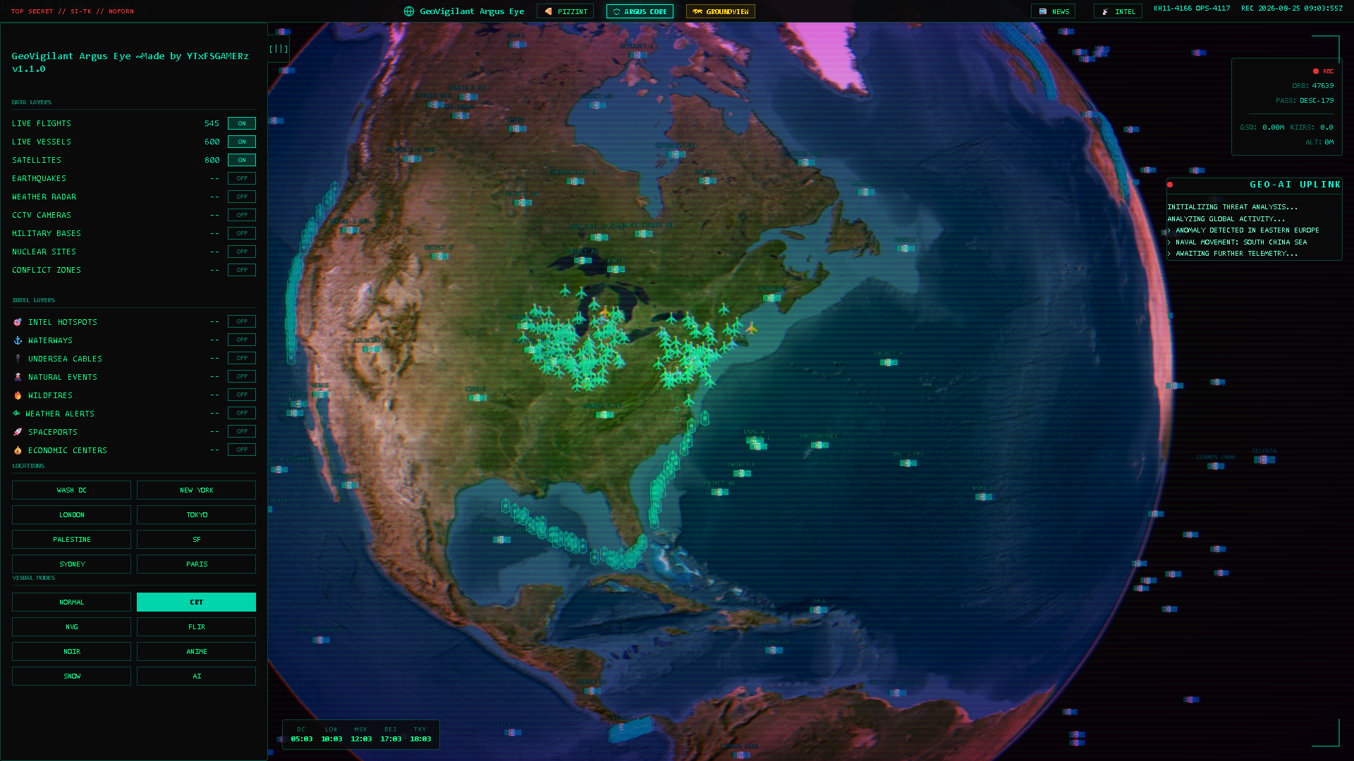
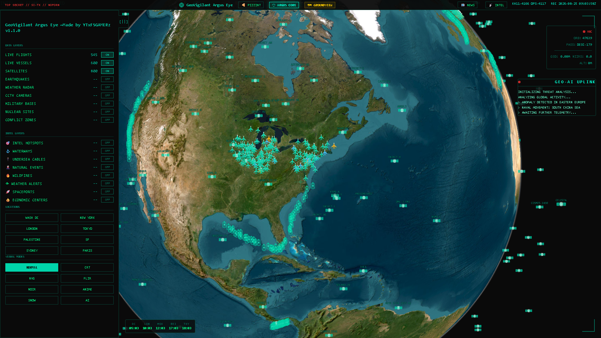
Photorealistic 3D Earth powered by CesiumJS 1.114, ArcGIS World Imagery, and OSM 3D extruded buildings. Ingests 17+ simultaneous live OSINT feeds with hardware-accelerated GLSL shaders.
- Global OpenSky ADS-B flights (6 continents)
- AISStream live maritime fleet & naval corridors
- 800+ real-time LEO/GEO satellites via TLE
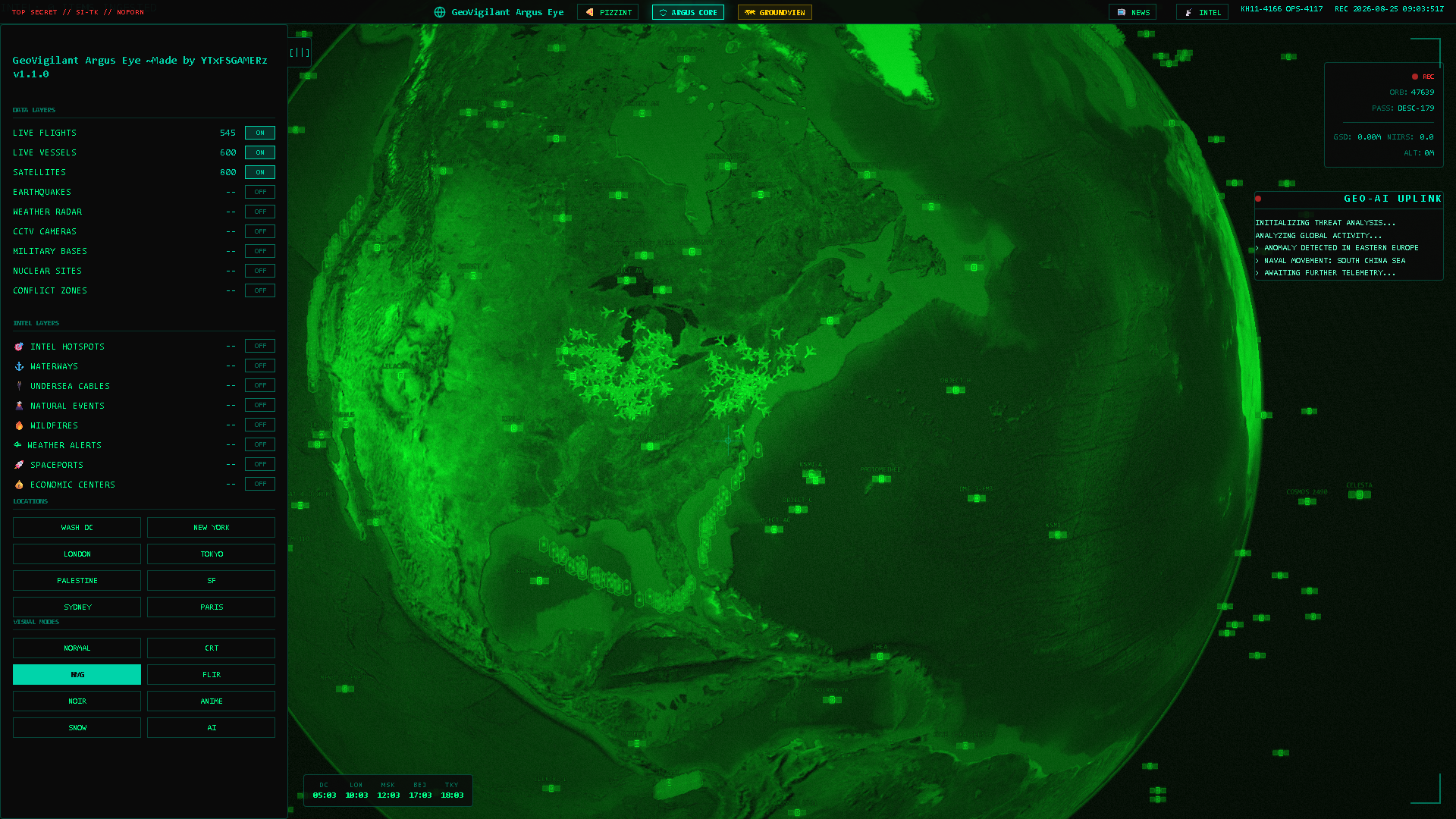
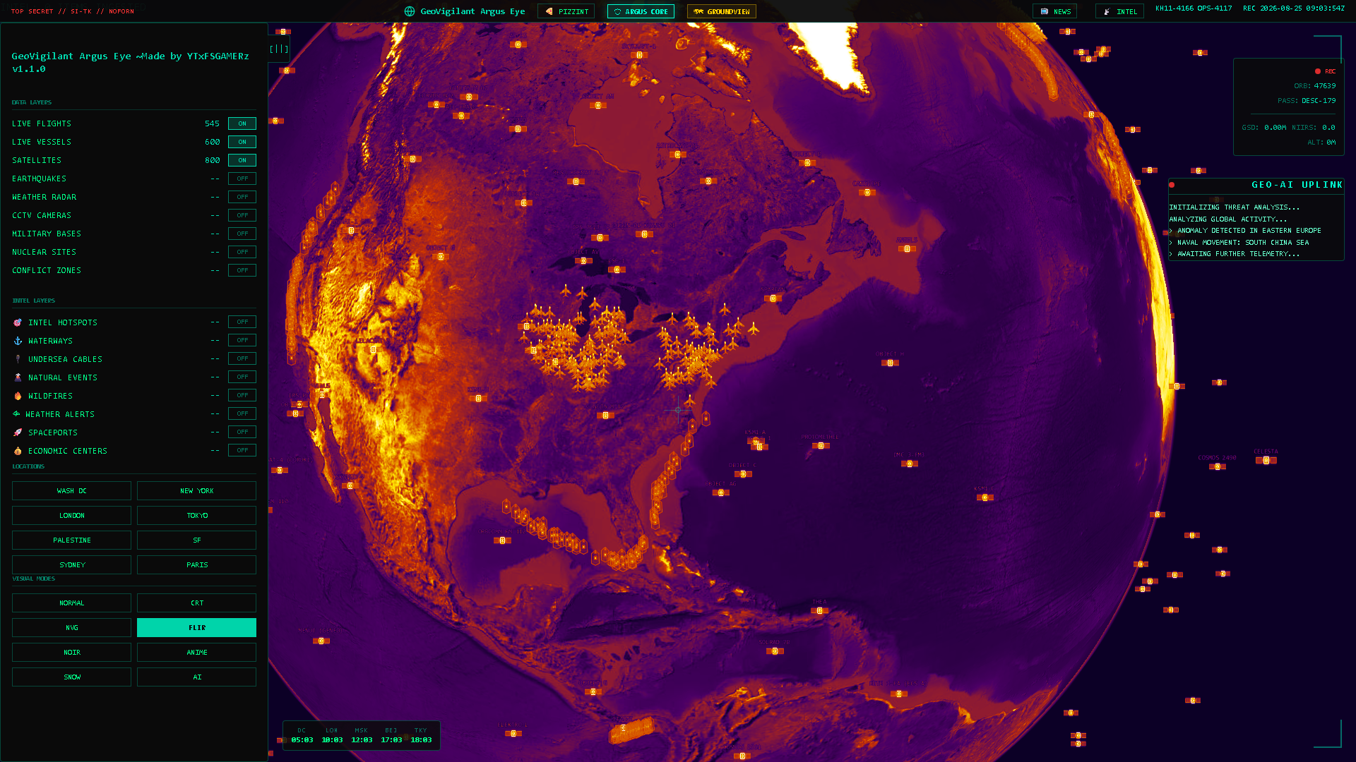
- 7 GLSL sensor modes (NVG, FLIR, CRT, Noir)
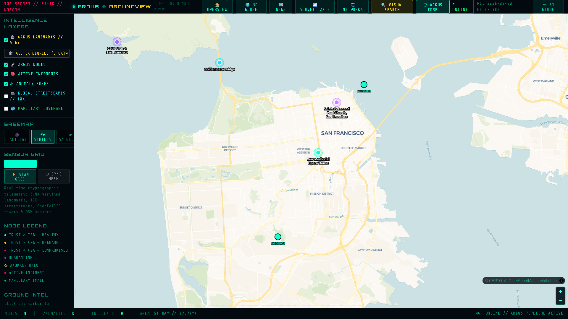
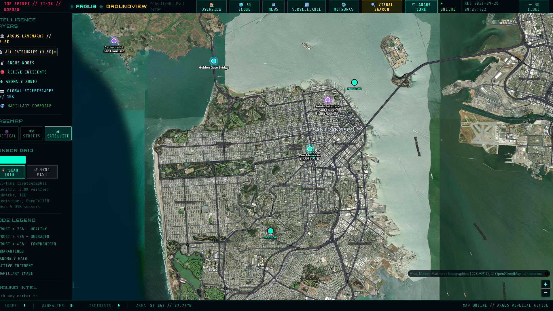
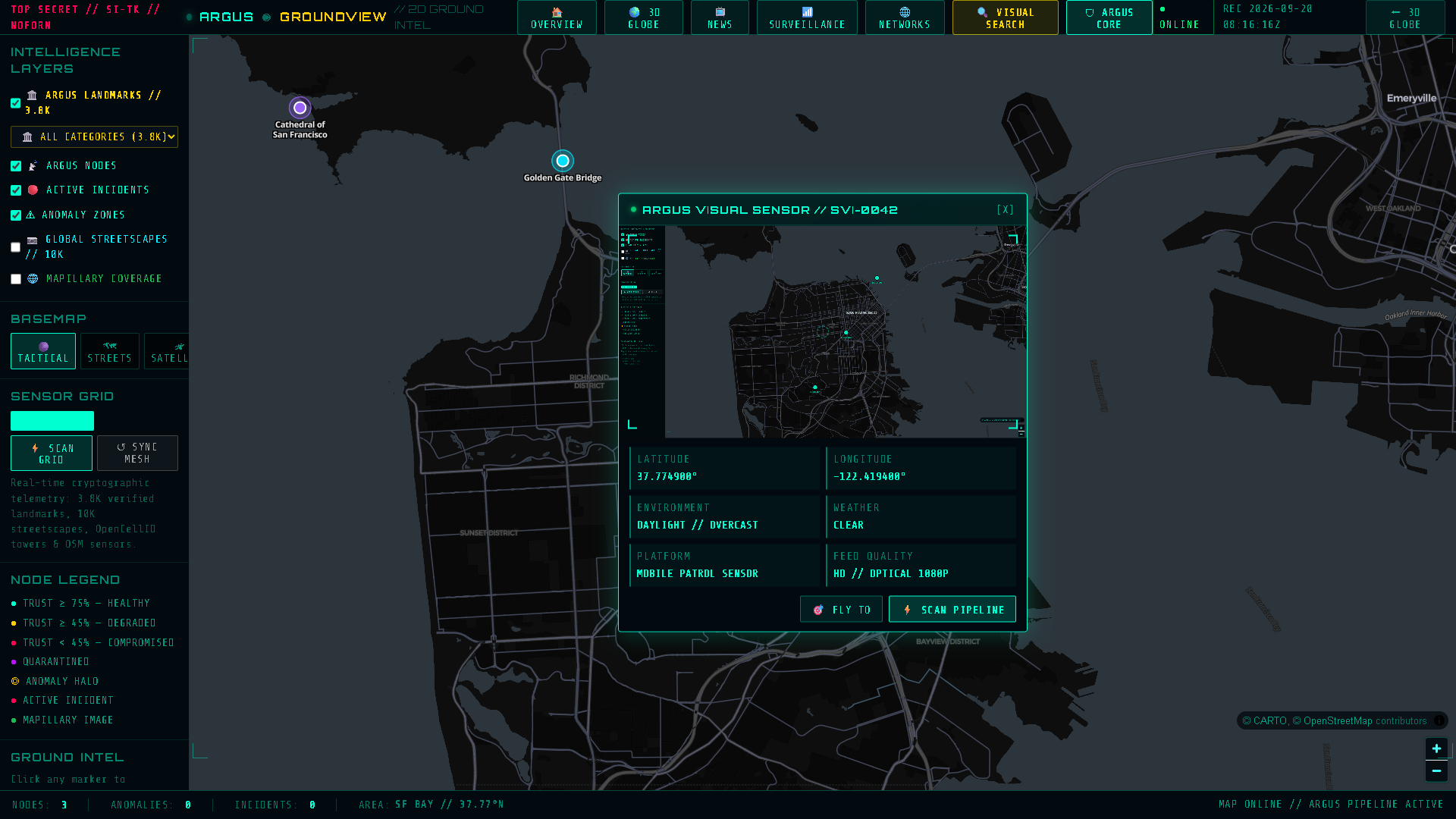
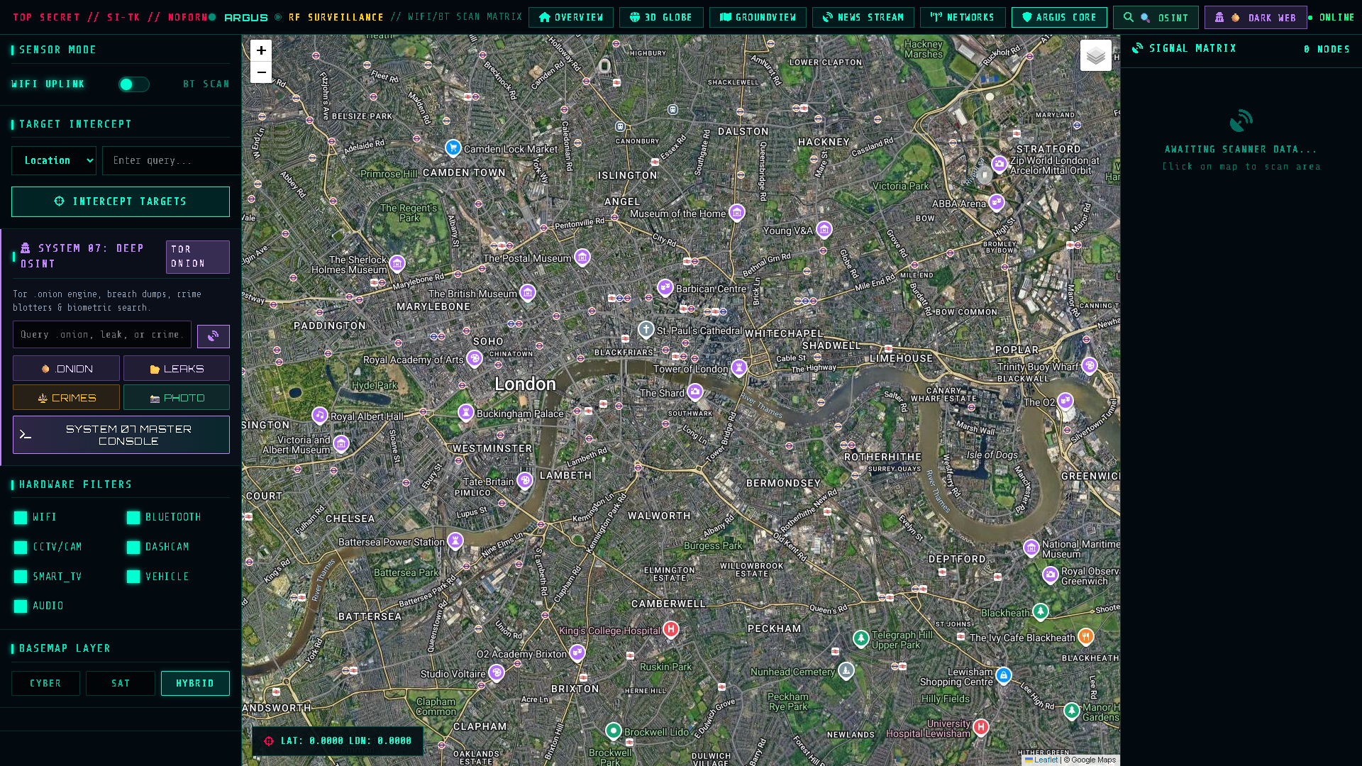
Sub-second, air-gapped 2D tactical workspace engineered with MapLibre GL 6.4. Isolated from Cesium with a 61.9 kB footprint, live Ed25519 node keystore, and autonomous incident quarantine.
- Ed25519 signed telemetry & CRC-16 hardware frames
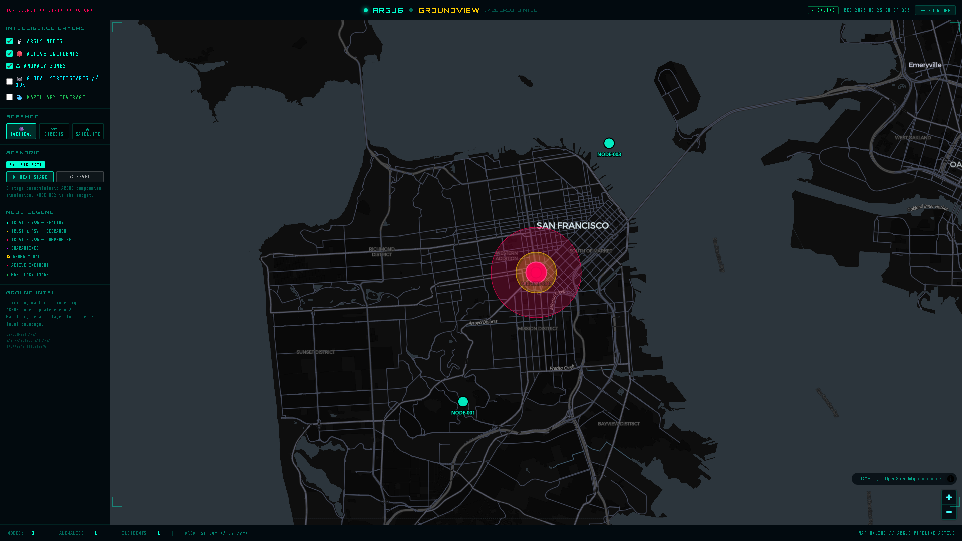
- 4-stage incident attack simulation & triage
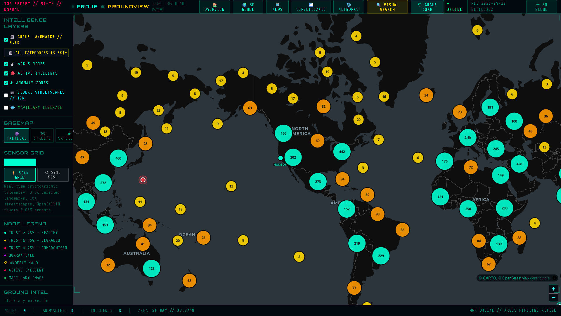
- Tactical Dark, Streets & Maxar Satellite basemaps
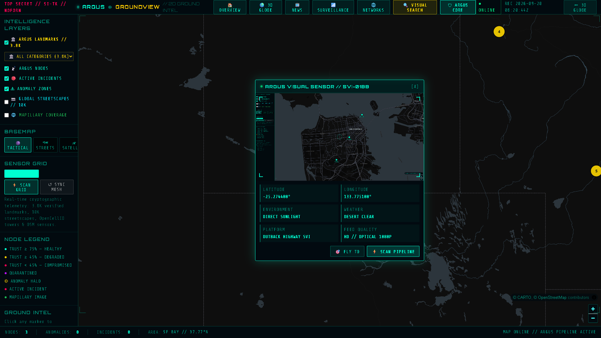
- 10,000+ SVI panoramic street-level sensor nodes
Autonomous landmark and streetscape intelligence database with 88,828 verified assets across 162 sovereign nations. Features 64-bit DCT perceptual hashing and BK-Tree metric space search.
- 88,828 visual assets, 3,806 places in SQLite
- < 0.4 ms BK-Tree Hamming distance query latency
- Reverse photo geolocation from drone/CCTV captures
- Pre-computed GeoJSON & high-res image streaming
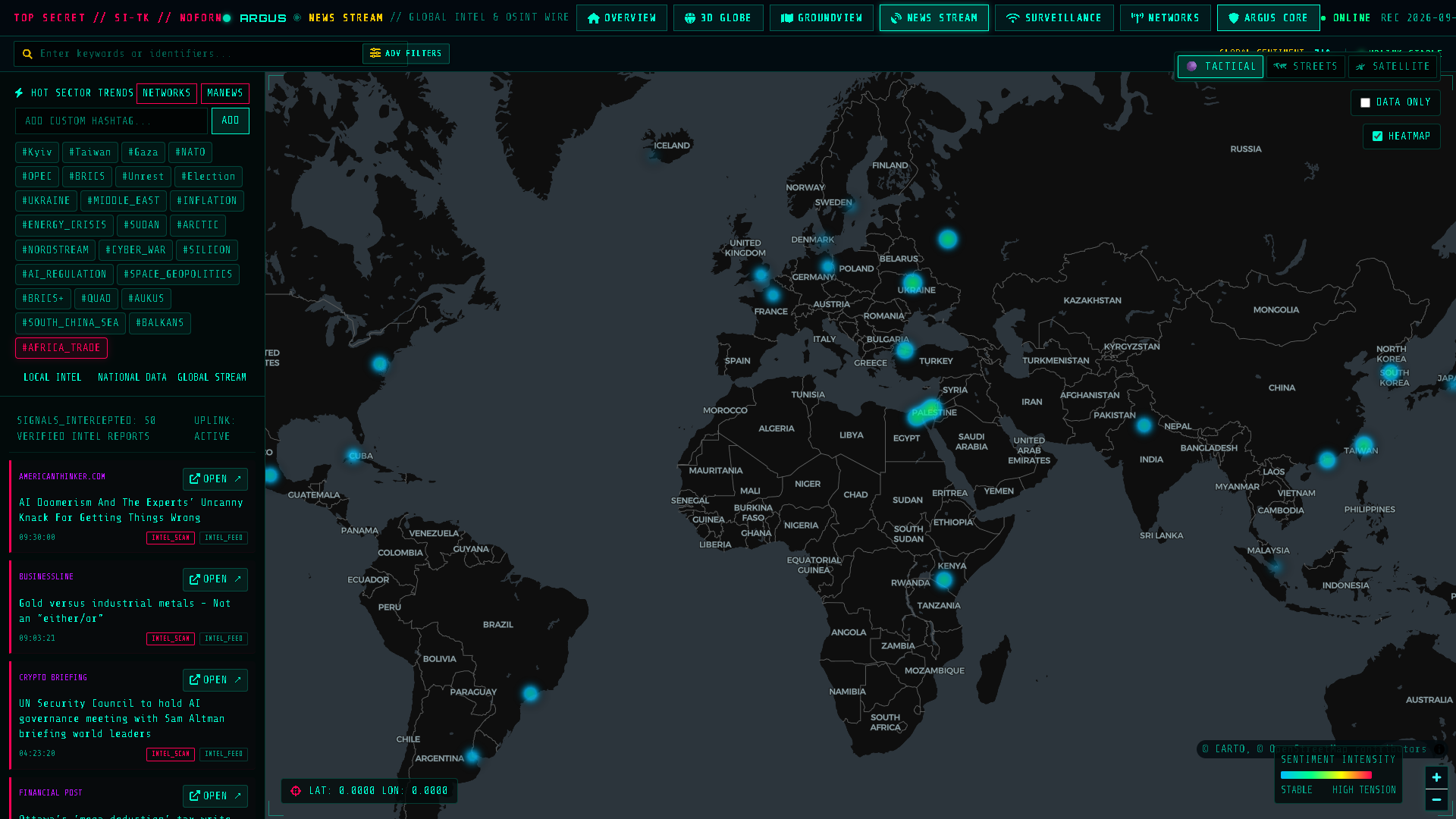
Real-time multi-source OSINT news aggregator monitoring 100+ global networks across 6 continents. Integrates VADER NLP sentiment analysis and regional geopolitical crisis tension indexing.
- Live RSS & API streams from 100+ news agencies
- NLP sentiment scoring (-1.0 to +1.0) on world events
- Hot crisis theater tracking (Middle East, Eastern Europe)
- Automatic geocoding of breaking incident coordinates
Wireless BSSID/SSID triangulation powered by WiGLE API, cellular tower mapping via OpenCellID, Bluetooth beacon sniffing, MAC vendor lookups, and Pentagon Pizza Index (PIZZINT) surveillance.
- WiGLE WiFi BSSID/SSID location triangulation
- OpenCellID cellular tower LAC/CID resolution
- PIZZINT real-time Pentagon delivery surge index
- Shodan IoT device open port vulnerability audits
Context-aware conversational intelligence assistant backed by ChromaDB RAG vector memory and multi-LLM routing (Llama 3.1 8B, Nemotron 3.5, or local air-gapped Ollama). Interactively controls the 3D globe.
- Autonomous globe commands ([TRACK_FLIGHT], [SCAN_MAP])
- ChromaDB vector memory maintaining session context
- Live web grounding via DuckDuckGo, Bing & Google
- 2° Geopolitical Threat Matrix on coordinate hover
Integrated SOCKS5 Tor proxying routing through local onion daemons or Ahmia clearnet fallback. Discovers hidden services, paste dumps, criminal database lookups, and deep investigative leads.
- Tor SOCKS5 proxy on ports 9050 / 9150 with Ahmia bridge
- .onion search querying Ahmia, OnionLand, and Torch
- Pastebin & BreachForums dump scanning pipeline
- Criminal photo, crime report & social aggregator
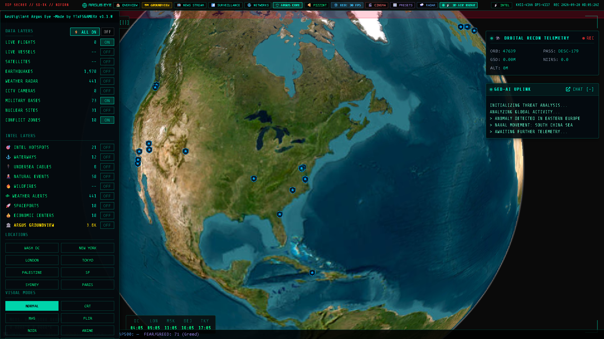
Macro-Level Global Situational Awareness
Renders a physically-accurate, real-time 3D globe powered by CesiumJS 1.114 with ArcGIS World Imagery and OSM 3D Building extrusion. Ingests and visualizes 17+ simultaneous live OSINT feeds with customized hardware-accelerated GLSL post-processing pipelines.
-
17+ Real-Time Streaming Telemetry Layers OpenSky ADS-B (flights), AISStream (maritime shipping), N2YO / SatNOGS (orbital satellites), USGS (seismic tremors), NOAA & Open-Meteo (weather radar), CCTV live proxies, and NASA FIRMS / EONET (wildfires & hazards).
-
Custom GLSL Post-Process Pipeline Hardware fragment shaders for NVG Night Vision, FLIR Thermal, CRT Raster Scanlines, Noir, Anime Cel-Shading, Snow, and SAR AI modes.
-
PANOPTIC Tactical AI Object Detection Real-time computer vision sweep rendering dynamic HUD bounding boxes around planetary coordinates, classifying anomalies into Vehicle, Aircraft, Vessel, Building, or Personnel with confidence ratings.
Global military installations including Diego Garcia, Ramstein, Yokosuka, Norfolk, Sevastopol, and Tartus with coordinates and strategic designations.
IAEA-tracked nuclear power stations, enrichment sites, and research reactors (Zaporizhzhia, Dimona, Natanz, Bushehr, Sellafield).
Critical naval passage choke points: Strait of Malacca, Hormuz, Bab-el-Mandeb, Suez Canal, Panama Canal, Bosphorus, and Gibraltar.
Trans-oceanic submarine internet backbone cable landing points and routing coordinates underpinning global communications.
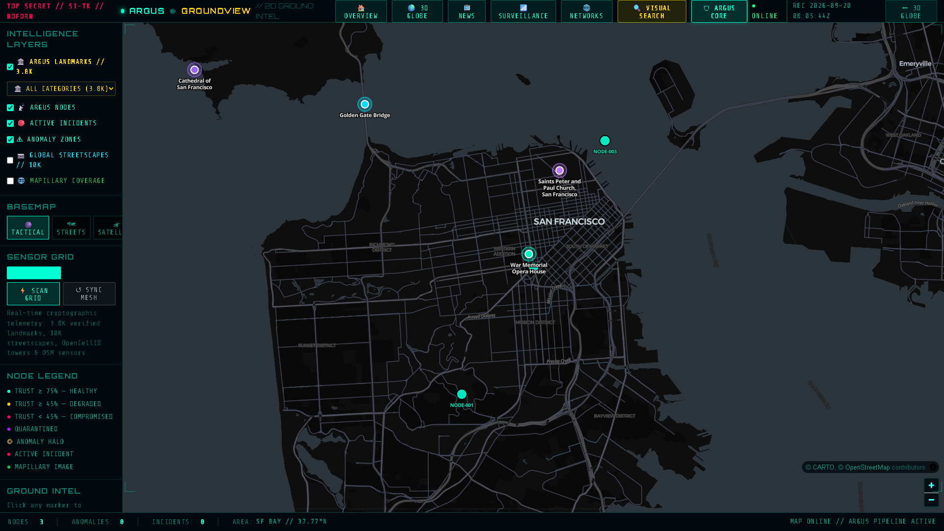
Micro-Level Tactical Precision & IoT Mesh
An ultra-fast, air-gapped 2D tactical workspace engineered with MapLibre GL JS. Decoupled completely from Cesium to maintain an isolated 61.9 kB footprint. Integrates live Ed25519 cryptographic IoT node telemetry, street-level sensor imagery, and automated incident triage.
-
Ed25519 Signed Telemetry & CRC-16 Frame Protocol Every telemetry frame carries a hardware CRC-16 checksum, monotonic replay nonce, and 64-byte Ed25519 digital signature verified against local public keys.
-
10,000+ Streetscapes & SVI Sensor Network Global street-level sensor points with optical panoramic inspection HUD, camera azimuth angles, elevation, and high-resolution camera feeds.
-
Autonomous Anomaly Engine & Trust Scoring Real-time mathematical trust calculation $T_n(t)$ with GPS spoofing drift detection, nonce replay protection, and one-click quarantine containment.
Calculates real-time authenticity score for every edge sensor node, decaying exponentially over silence and collapsing immediately under anomalous drift or replay.
Converts street images into 64-bit frequency finger-prints. Indexed into a Burkhard-Keller metric tree for sub-millisecond Hamming distance retrieval.
Transforms NORAD Two-Line Element (TLE) mean motion $n$ (revolutions/day) into orbital radius $r$ and real-time Keplerian state vectors.
Calculates relative luminance across WebGL fragment passes using standard ITU-R BT.601 coefficients and 4-stage color ramp interpolation.
| Domain / Layer | Node Source Provider | Ingestion Protocol | Update Rate | Payload Type | Strategic Mission Value |
|---|---|---|---|---|---|
| Live Flights | OpenSky Network & Radar Hubs | REST / JSON | 10 Seconds | ADS-B Vectors | Real-time global airspace monitoring, altitude, velocity & squawks |
| Maritime Vessels | AISStream.io & Marine Traffic | WSS / JSON | Live Stream | AIS NMEA Frames | Commercial shipping, oil tankers, cargo & naval fleet corridors |
| Orbital Satellites | SatNOGS DB & CelesTrak | TLE / Math | Calculated Live | Keplerian TLE | 800+ LEO/GEO satellite positioning, orbit footprints & passes |
| Earthquakes | USGS Earthquake Hazards API | GeoJSON | 60 Seconds | Seismic Events | Instant seismic events with magnitude-scaled shockwave rings |
| Weather Radar | Open-Meteo & NOAA NWS | REST / Tiles | 5 Minutes | Precip / Wind | Live precipitation levels, atmospheric pressure & storm tracking |
| Wildfires & Thermal | NASA FIRMS (VIIRS / MODIS) | CSV / GeoJSON | 15 Minutes | Thermal Blooms | Active wildfire perimeters, forest burns & thermal anomalies |
| CCTV Surveillance | Worldwide Traffic & Security Nodes | HLS / MJPEG | Real-Time | Video Stream | Ground visual inspection with analog CRT scanline overlay |
| WiFi & Cell Towers | WiGLE API & OpenCellID | REST / Bearer | On-Demand | BSSID / CID | Wireless signal triangulation, cell tower geolocation & BLE beacons |
| PIZZINT Index | Pentagon, CIA & NSA Activity | REST / Intel | Real-Time | Foot Traffic Surge | Late-night pizza delivery surges as an early-warning geopolitical proxy |
| OSINT News & RSS | 100+ Global News Agencies | RSS / NLP | 15 Minutes | VADER Sentiment | Multi-nation crisis sentiment, conflict headlines & topic clustering |
| Space Weather | NOAA SWPC (Space Weather Prediction) | JSON Stream | 60 Seconds | Kp / Solar Flux | Geomagnetic storm warning (G0-G5), radio blackouts & GPS scintillation |
| ARGUS GroundView | Verified Landmark & Street Database | SQLite / pHash | Local / <0.4ms | 64-Bit pHash | 88,828 verified visual assets across 162 nations for reverse search |
"Good morning respected judges! We present GeoVigilant Argus Eye — an autonomous, defense-grade geospatial intelligence and zero-trust cyber-physical surveillance suite. While traditional systems blindly trust incoming sensor data — making them easy targets for GPS spoofing and replay attacks in modern warfare — Argus Eye introduces a cryptographic zero-trust telemetry pipeline using Ed25519 signatures and mathematical trust decay. Combined with a dual-engine 3D Cesium and 2D MapLibre interface and an 88,000+ visual landmark reverse geolocation engine that resolves coordinates in under 0.4 milliseconds, Argus Eye delivers unmatched multi-domain situational awareness for mission-critical defense."
- Minute 1: Launch 3D Globe HUD (/earth) → Show 17+ simultaneous live layers (flights, ships, satellites, seismic shockwaves). Cycle through GLSL Shaders (NVG Night Vision, FLIR Thermal). Press
Ctrl+Pto trigger PANOPTIC AI object detection. - Minute 2: Transition to 2D GroundView (/ground) → Explain the 61.9 kB decoupled bundle. Show the Ed25519 Keystore. Trigger the 4-Stage Attack Scenario (Normal → Replay Attack → Velocity Spoof → Autonomous Quarantine Halo). Inspect an SVI 360° panoramic sensor node.
- Minute 3: Reverse Visual Search & PIZZINT (/surveillance) → Explain the 88k+ landmark dataset with BK-Tree 64-bit DCT pHash (<0.4ms match). Show the Pentagon Pizza Index (PIZZINT) activity monitor and trigger the local ARGUS AI Core to demonstrate autonomous map navigation.
Q: How does Argus Eye prevent false positives when detecting GPS spoofing?
A: We use a multi-variable decay equation $T_n(t)$. A single GPS jitter doesn't cause quarantine. Quarantine only triggers when spatial velocity exceeds physical vehicle thresholds ($\|\Delta \mathbf{x}\| / \Delta t > v_{\max}$), signature verification fails, or replay nonces are reused.
Q: Why decouple 3D Cesium from 2D MapLibre instead of putting everything into one map?
A: CesiumJS is a 115 kB heavy WebGL planetary globe engine. If loaded alongside tens of thousands of IoT nodes and streetscapes, DOM rendering and WebGL context switching causes browser crashes and frame drops. MapLibre GL is an isolated 61.9 kB client that runs at 60 FPS even on low-power edge field laptops.
Q: Can Argus Eye operate completely offline in an air-gapped SCIF / defense facility?
A: Yes! The entire landmark dataset (88,828 assets in SQLite + BK-Tree pHash), the MapLibre 2D vector basemaps, and the local ARGUS AI (powered by Ollama with phi/llama3.1 and ChromaDB vector embeddings) run 100% locally with zero internet dependency.
Q: What is the Pentagon Pizza Index (PIZZINT) and why is it useful?
A: PIZZINT is a recognized historical OSINT proxy. During the Gulf War and major military operations, sudden late-night spikes in food delivery orders to defense headquarters (Pentagon, CIA, NSA) consistently preceded major geopolitical escalations by 24–48 hours.
1→ Jump to 3D Globe HUD (/earth)2→ Jump to 2D GroundView (/ground)3→ Jump to OSINT News Stream (/news)4→ Jump to RF / WiFi Tracker (/surveillance)5→ Jump to News Networks (/newsnetworks)6→ Smooth scroll to Live Telemetry Grid7→ Smooth scroll to Media Gallery8→ Smooth scroll to Mathematical Formulas9→ Smooth scroll to Presenter Cheat SheetP→ Toggle Expo Presentation Kiosk ModeEsc→ Close all modals & Lightbox
- IoT Sensor Mesh (Ed25519)
- OpenSky ADS-B Ingestion
- AISStream Marine Feeds
- N2YO Satellite Orbit TLEs
- USGS Seismic GeoJSON
- NASA FIRMS / EONET v3
- CRC-16 Frame Validation
- Ed25519 Signature Checks
- Monotonic Nonce Engine
- Timestamp Drift Guard
- Hardware Keystore (3 Nodes)
- Latency: < 0.4ms / frame
- Mathematical Trust Decay
- GPS Drift Velocity Checks
- PANOPTIC Grounded AI
- Autonomous Quarantine
- Deterministic Scenarios
- PIZZINT Activity Index
- 3D Globe: Cesium.js (115 kB)
- 2D Ground: MapLibre (62 kB)
- Custom GLSL Shader Pipeline
- Supercluster (10k points)
- Flask WSGI + Vercel Functions
- Zero-Bloat Bundle Isolation